Storm today brings gusty winds, snow and flooding risk – NBC Boston
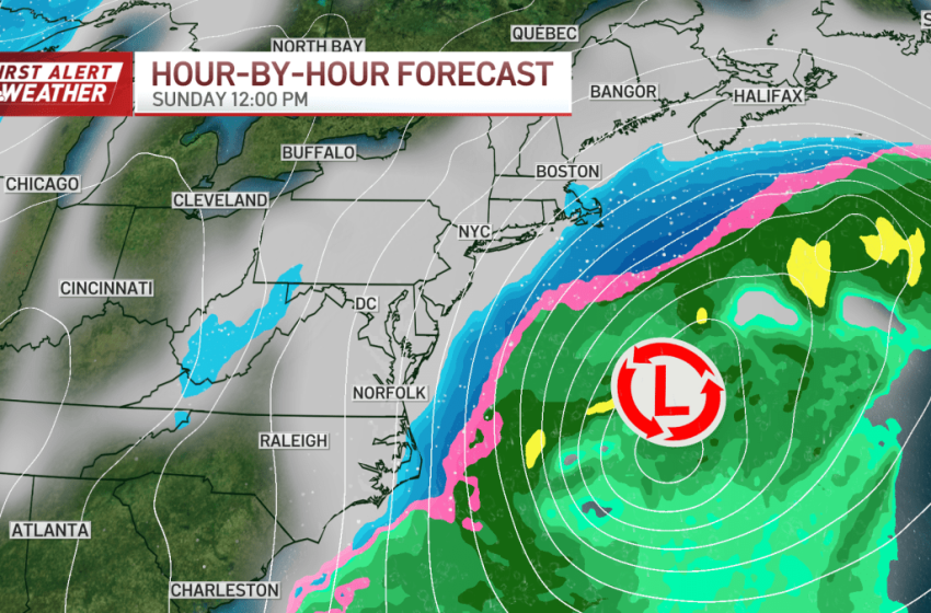
The coastal storm we’ve been watching for Sunday continues to trend farther offshore. That said, it will still graze the coast, bringing gusty wind, snow and the risk of coastal flooding for the Cape, and the south and north shores.
The greatest impacts will be focused on Cape Cod and the Islands.
How much snow will Massachusetts get?
Snowfall amounts have been trimmed back, now generally 1–3 inches, with Nantucket possibly closer to 4 inches, especially where ocean-effect snow bands linger the longest.
Some narrow bands may also brush parts of coastal Plymouth County and Cape Ann, where localized accumulation over an inch is possible.
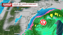
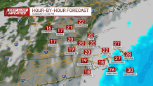
Storm timing
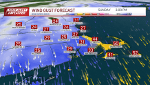
Strong winds and threat of coastal flooding
Strong winds gusting 40–50+ mph will cause blowing snow and sharp drops in visibility at times along the coast and 30-40 mph gusts inland will make a chilly Sunday feel colder.
Minor to locally moderate coastal flooding is possible with a flood advisory along the coastline and a coastal flood warning for Nantucket. The risk is mainly Sunday morning through Monday afternoon during high tide times.
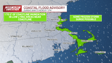
Flooding issues could linger as surge water freezes on cold roads and slows drainage.
Live radar
Weather alerts
There are coastal flood warnings and advisories, as well as wind, winter weather, and cold weather advisories.
Click here for active weather alerts
Deep cold
Behind all of this, the deep cold isn’t going anywhere. Temperatures stay cold enough all weekend that nothing melts. Any snow that falls Sunday plus existing snowbanks and icy patches stay locked in place.

Even as we head into next week and temperatures slowly creep back to the 30s, readings remain mainly below freezing, so snowbanks shrink slowly, if at all. Roads, sidewalks, and coastal floodwaters that freeze will take time to improve.
First Appeared on
Source link

