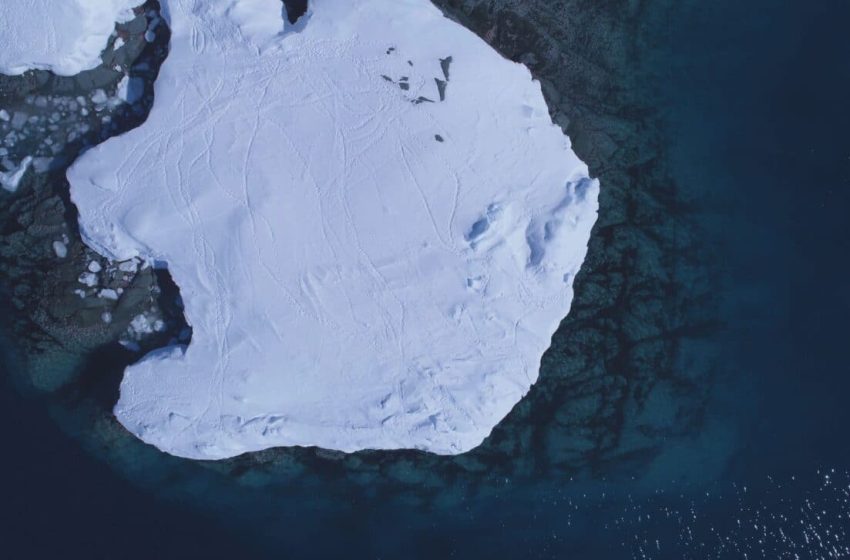
Scientists Just Unveiled a New Map of Antarctica, and What’s Under is Bigger Than Anyone Expected
For the first time, scientists have mapped Antarctica’s buried landscape in high resolution beneath the continent’s thick ice sheet. The results uncover geological features previously invisible to researchers and promise to improve how ice sheet behavior is understood.
The map, created by combining satellite data and physics-based modeling, captures the most detailed view yet of the subglacial topography. The findings include tens of thousands of formations and a massive under-ice channel, offering new insight into how Antarctic ice may behave over time.
Tens of Thousands of Unseen Features Emerge
While previous maps relied heavily on radar surveys with significant gaps between measurements, this new approach reduces uncertainty by filling in those blind spots. According to Helen Ockenden, lead author from Grenoble Alpes University, the difference is like going “from a grainy pixel film camera” to “a properly zoomed-in digital image.”
Researchers involved in the study, published in Science, uncovered a massive amount of previously unknown subglacial features. Using a combination of satellite observations and modeling based on the physics of ice flow, the team identified tens of thousands of hills and ridges buried beneath the Antarctic Ice Sheet.
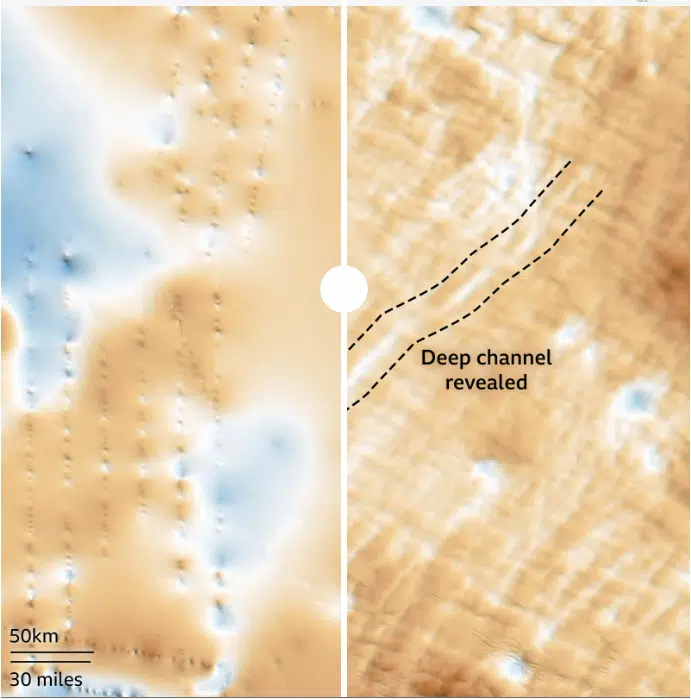
Giant Channel Discovered Under Antarctica
One of the most striking findings was a vast bedrock channel hidden in the Maud Subglacial Basin. The formation runs almost 400 kilometers in length, measures about 6 kilometers wide, and reaches a depth of approximately 50 meters. This feature had never been observed in such detail before.
The maps produced through this project improve upon past radar-based efforts, which often had gaps hundreds of kilometers wide between flight lines. According to Peter Fretwell of the British Antarctic Survey:
“This is a really useful product,” he said “It gives us an opportunity to fill in the gaps between those surveys.”
High-Resolution Maps Reshape Antarctic Knowledge
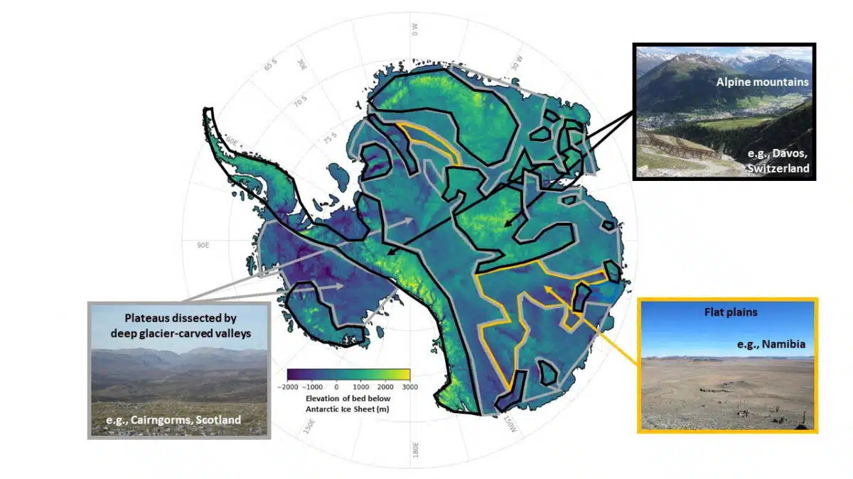
To create the map, scientists used satellite information and models that simulate how ice flows over different terrains. This method helped reconstruct the unseen parts of Antarctica’s bed, offering a more complete and consistent view across the continent.
The previous data often left researchers guessing about what lay between radar lines. Now, with a more refined digital elevation model, they can observe patterns in the terrain that influence glacial movement. These include mountain ranges, deep valleys, and narrow ridges, features that can speed up or slow down the ice above them.
Ockenden emphasized the clarity this new approach offers. Instead of patchy glimpses, the scientific community now has a continuous view that shows the real complexity of the land hidden beneath the ice.
“I think it’s just really super interesting to look at all these new landscapes and see what’s there,” she said, “It’s like when you see a map of topography on Mars for the first time, and you’re like, ‘whoa, this is so interesting, this looks a bit like Scotland,’ or ‘this looks like nothing I’ve ever seen before.”
A New Antarctica Emerges
Beyond the data, the emotional reaction from the research team speaks volumes. Professor Robert Bingham of the University of Edinburgh, a co-author of the study, said he was “just so excited to look at that and just see the whole bed of Antarctica at once.”
The map presents not only a scientific milestone but also a moment of wonder for those who have studied the continent for years with limited visibility. Seeing Antarctica’s full subglacial terrain in one piece brings together decades of fragmented data into a single, coherent image.
According to Bingham, the sense of discovery is profound. The Antarctic continent, long shrouded in mystery beneath kilometers of ice, is finally beginning to show its true shape.
First Appeared on
Source link

