NASA Just Mapped Earth’s Seafloor From Space, and Made a Discovery Scientists Didn’t See Coming
A new global seafloor map generated using data from NASA’s SWOT satellite marks a major leap in ocean science, offering unprecedented detail of underwater terrain and revealing features previously invisible from space, according to a study supported by NASA.
A Technological Leap In Ocean Mapping
The ocean floor has long remained one of Earth’s least explored frontiers, largely due to the difficulty and cost of ship-based sonar mapping. The arrival of the Surface Water and Ocean Topography (SWOT) satellite has begun to change that reality in a profound way. By measuring subtle variations in sea surface height caused by gravitational differences, SWOT can infer the structure of the seafloor below with remarkable precision. This technique allows scientists to map vast areas of the ocean much faster than traditional methods, dramatically accelerating global efforts to understand underwater landscapes.
The impact of this advancement extends far beyond academic curiosity. The newly generated map reveals fine-scale features such as underwater hills, ridges, and tectonic structures that were previously blurred or entirely undetectable. These details are essential for improving models of ocean circulation, plate tectonics, and even climate systems. Researchers emphasize that the resolution achieved by SWOT represents a step change, not an incremental improvement, in how humanity observes its own planet. The satellite’s ability to continuously scan large swaths of ocean provides a dynamic and evolving picture rather than a static snapshot, opening the door to ongoing discoveries.
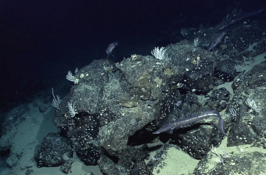
Credit: NASA Earth Observatory
Why This Discovery Matters For Science And Industry
The implications of this new seafloor map are vast, touching fields ranging from geology to global economics. According to NASA, understanding the structure of the ocean floor is directly linked to resource management, environmental monitoring, and national security. The data can help identify mineral-rich regions, optimize maritime routes, and improve hazard detection systems such as tsunami forecasting.
“Seafloor mapping is key in both established and emerging economic opportunities, including rare-mineral seabed mining, optimizing shipping routes, hazard detection, and seabed warfare operations,” said Nadya Vinogradova Shiffer, head of physical oceanography programs at NASA Headquarters in Washington.
This broader relevance highlights how ocean mapping is no longer just a scientific endeavor but a strategic priority. Nations and industries alike are increasingly dependent on accurate marine data for decision-making. With SWOT delivering consistent global coverage, the balance is shifting from sparse, localized surveys to comprehensive planetary insight. This shift could reshape how governments and private sectors approach ocean-related challenges in the coming decades.
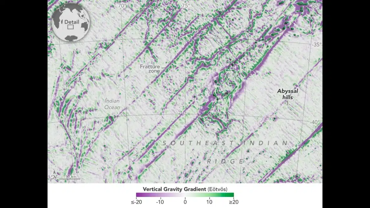
A Clearer View Of Earth’s Most Common Landform
One of the most surprising outcomes of the SWOT mission is its ability to detect abyssal hills, small underwater formations that cover a majority of the ocean floor. Despite their abundance, these features have remained difficult to observe due to their relatively small size and the limitations of previous satellite technology.
“Abyssal hills are the most abundant landform on Earth, covering about 70% of the ocean floor,” said Yao Yu, an oceanographer at Scripps Institution of Oceanography and lead author on the study. “These hills are only a few kilometers wide, which makes them hard to observe from space. We were surprised that SWOT could see them so well.”
This breakthrough provides scientists with a more complete understanding of seafloor geology and the processes that shape it. Abyssal hills are formed by tectonic activity and volcanic processes, making them valuable indicators of Earth’s geological history. By mapping these features in detail, researchers can refine models of plate movement and better understand how the ocean crust evolves over time. The ability to observe such small-scale structures from orbit represents a major milestone in Earth observation.
Decades Of Progress Culminate In A New Era
The SWOT-based map builds on decades of research led by scientists who have worked to piece together the ocean floor using indirect measurements. Among them is David Sandwell, a geophysicist at Scripps Institution of Oceanography, who has been mapping the seafloor using satellite data since the 1990s.
“The SWOT satellite was a huge jump in our ability to map the seafloor,” Sandwell said. His team contributed to the map published in the journal Science in December 2024, marking a significant milestone in oceanography.
The long-term goal remains ambitious: to produce a complete, high-resolution map of the global seafloor by 2030. While ship-based sonar will still play a role, satellite data is becoming an essential tool for filling gaps and accelerating progress.
“We won’t get the full ship-based mapping done by then,” Sandwell said. “But SWOT will help us fill it in, getting us close to achieving the 2030 objective.”
This combination of traditional and space-based techniques reflects a hybrid future for ocean exploration. Satellites provide breadth, while ships deliver depth, together forming a comprehensive approach that was previously unattainable.
A New Window Into Earth’s Final Frontier
The unveiling of this global seafloor map signals a turning point in how humanity explores its own planet. With NASA and its partners pushing the boundaries of satellite technology, the once-hidden depths of the ocean are becoming increasingly visible and understandable. Each new dataset adds clarity to a world that has remained largely out of reach, despite covering more than 70% of Earth’s surface.
As SWOT continues its mission, scientists expect even more refined maps and unexpected discoveries. The ocean floor, long considered the last unexplored frontier on Earth, is now entering an era of rapid revelation driven by space-based observation.
First Appeared on
Source link

