Why the Strait of Hormuz is a geological wonder
The region is also known for its salt glaciers and salt domes created as the salt from deep within the Earth was pushed up through the folds created by the continental collision. “In places it literally flows down the hillsides like a rock glacier,” Allen says.
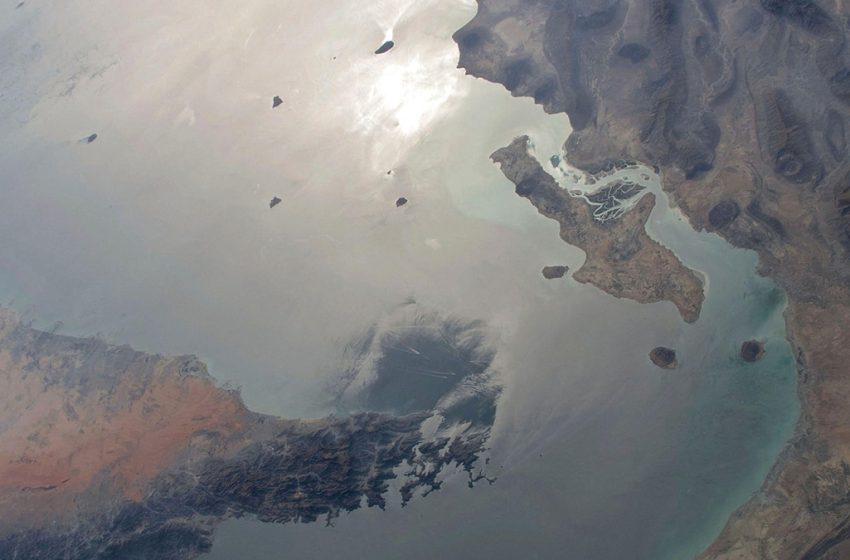
To the south, the Musandam Peninsula is part of the Al Hajar Mountains in Oman that run all the way down the northeast coast of Arabia. Those mountains are mostly composed of ophiolite, Searle says, a slab of the Tethyan oceanic crust and mantle that was thrust onto Arabia during a continental collision between 95 and 60 million years ago during the late Cretaceous. The same geologic forces that created the Strait of Hormuz also tilted the Musandam Peninsula eastward to the point where it pinches the Strait.
Most notably, this continental collision also gave the region its staggering oil reserves.
For hundreds of millions of years before the Arabian plate collided with Eurasia, it was sitting at just below sea level, Allen says, accumulating all the kinds of rocks needed to form oil and gas reserves. Over time, the collision of the plates trapped these pockets of oil and gas under the rocks in the northern end of the Arabian plate—which now sits underneath Iran, Iraq, and parts of Syria.
“What is distinctive about the Middle East is the sheer scale of it,” Allen says. “All of this happened over a vast area, over a long period of time, with traps that are huge so that economically you’re not spending all your money drilling into a reservoir that’s going to drain dry in a few years, they’ve got fields that last for many decades.”
First Appeared on
Source link

