Hurricane Melissa devastates Jamaica: in pictures
Hurricane Melissa left a trail of destruction as it moved across Jamaica, seen for the first time from space in new satellite images obtained from Vantor.
The storm made landfall in Jamaica on Tuesday as a monstrous Category 5 hurricane before moving onto to Cuba on Wednesday and later, the Bahamas.
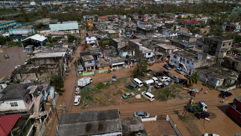
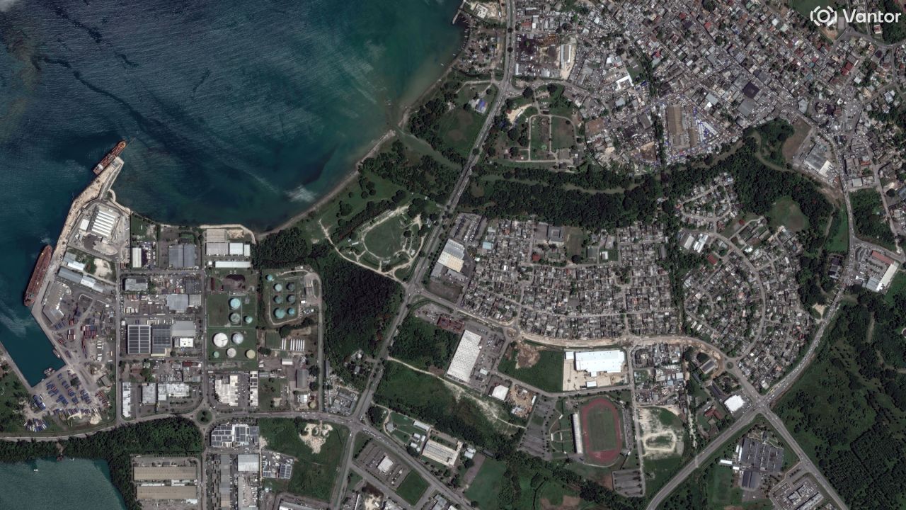
These aerial images show widespread flooding and extensive damage in towns along Jamaica’s southwest coast in the parish of St. Elizabeth and, on the opposite side of the island in Montego Bay, the capital of St. James parish. The storm first made landfall on Jamaica’s southwest coast near the town of Black River, seen in part here.
Damage to homes, businesses and community centers in Black River is extensive – even seen in this limited scope. This satellite photo taken after the storm shows the roof of one of the largest markets in the neighborhood ripped cleanly off its foundation.
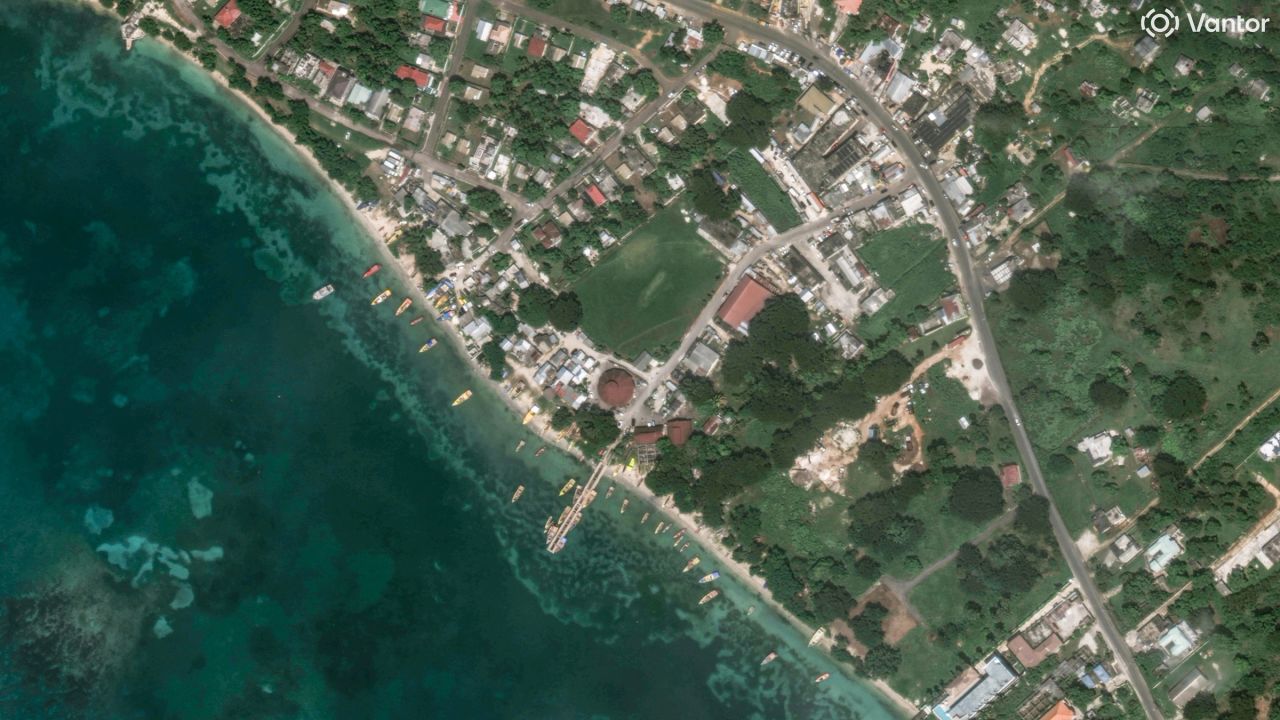
Coastal communities were hit hardest by the storm’s devastating winds, with some remote fishing villages nearly flattened by the hurricane. In the town of White House, less than 10 miles northwest of Black River, small boats were washed ashore in a town where the economy is reliant on its closeness to the Caribbean Sea.

As the storm progressed north, it drenched rural farmlands across St. Elizabeth Parish, a southwestern region that’s become Jamaica’s breadbasket. Footage captured on the ground showed just how quickly the low-lying farmlands were submerged by rainwater.
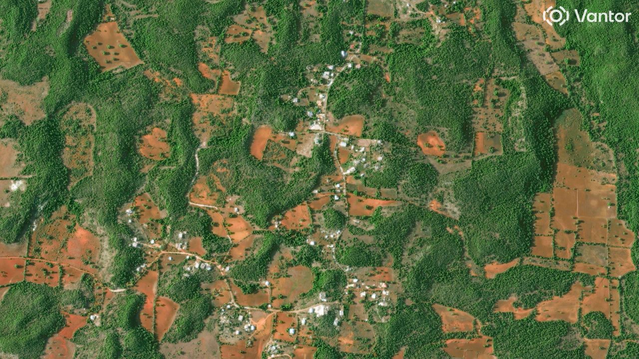
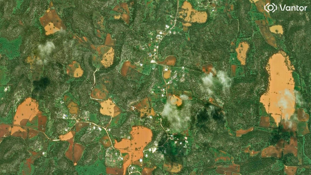
An image captured less than 24 hours after the floodwaters rushed in shows inundated farmlands and vegetation stripped from large swathes of agricultural land.
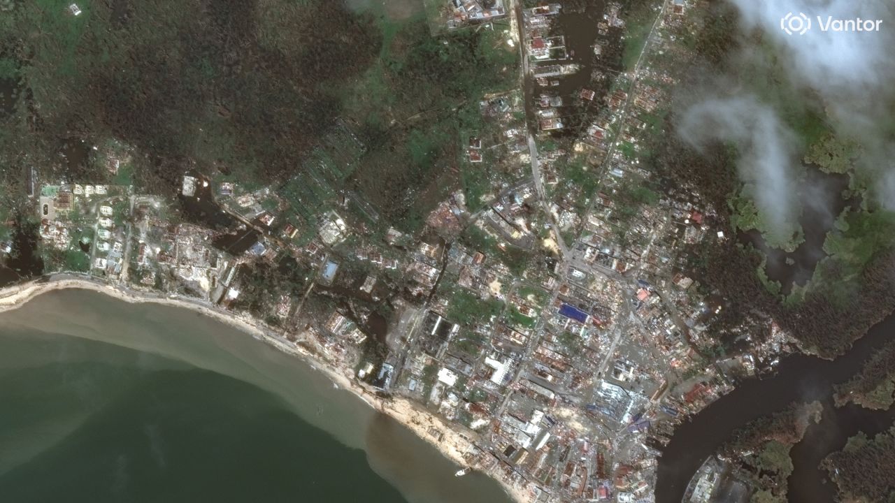
On the opposite coast, Hurricane Melissa swept through Montego Bay, in Jamaica’s north. This satellite image captured in its aftermath shows extensive flooding throughout the city and large pools of water around storage facilities at the city’s main port.
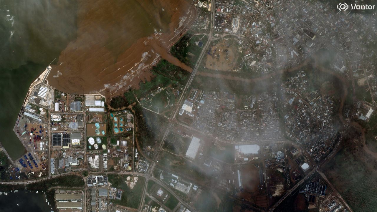
As the storm moved out to sea, it pulled debris and muddy water through the Barnett and Pye Rivers, seen at the center of the frame. The debris appears as a large cloud of dirty water seen beyond the shoals off Montego Bay.
First Appeared on
Source link

