Green River defies nature as it flows uphill for roughly 100 miles
Geologists have resolved a long-standing mystery about how two major rivers in the western United States became connected.
They found that a hidden shift deep underground briefly lowered a mountain barrier, allowing one river to cut straight through and join the other.
Where the river cuts
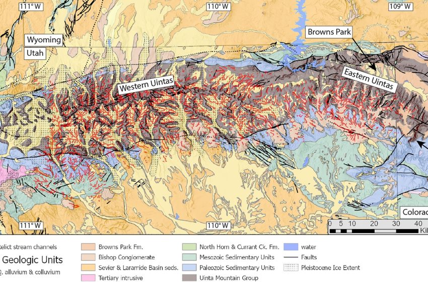
Across northeastern Utah, the Green River, the largest tributary of the Colorado River, slices through the east-west Uinta Mountains, carving the Canyon of Lodore inside Dinosaur National Monument.
Clues preserved in the river’s own shape led Dr. Adam G. G. Smith at the University of Glasgow to identify a deeper cause.
Smith argued the river carved across an already-built range, which ruled out the simplest keep-cutting explanation.
Instead, changes far underground likely lowered the barrier for a while, setting up the river’s seemingly uphill path.
A late river crossing
Between 8 and 1.5 million years ago, the new paper places the crossing through mountains already about 50 million years old.
Sediment clues downstream recorded when the Green and Colorado started sharing water, and the dates line up with that window.
Earlier explanations relied on a river capture from the south or a slow overtopping as valleys filled with gravel.
A more recent change in the mountain’s height fits the timing, and it points attention downward, not just to erosion.
The hidden drip
Deep under the mountains, a lithospheric drip, heavy deep rock peels off and sinks, can reshape the surface.
As the dense material pulls downward, the crust above can sag, then rise again after the blob breaks free.
That dip-and-rebound offers a way to explain a river crossing without asking water to climb a mountain ridge.
In this case, the idea puts the key movement in rock below the surface, not just in the river channel.
Rivers record uplift
Higher side valleys hold older, gentler river stretches that sit above newer steep segments carved into bedrock.
When ground rises or sea level falls, gravity gives water more power to cut, so lower reaches dig down faster.
Using those mismatched slopes, Smith’s team estimated the range gained about 1,300 feet of height in recent geologic time.
That rise gave the researchers a surface clue, and it pushed them to look for a matching signal deep below.
Imaging the deep
To check the deep story, the team turned to seismic tomography, underground imaging built from earthquake-wave speeds.
Beneath the Uinta Mountains in northeastern Utah, the imaging shows a round area where earthquake waves move faster about 125 miles underground, with slower-moving material above it.
Fast waves usually mean colder, denser rock, so the pattern fits a heavy root sinking away and leaving a hotter mantle behind.
Matching a deep anomaly with a surface record of uplift tightens the case that underground motion, not surface climate, drove the change.
A sag then rebound
Before the drip broke free, the land above it likely dipped, lowering the pass between the Green and Colorado systems.
Once water spilled across that lowered barrier, the new connection let the Green cut a path and keep it as uplift returned.
“We think that we’ve gathered enough evidence to show that lithospheric drip, which is still a relatively new concept in geology, is responsible for pulling the land down enough to enable the rivers to link and merge,” said Smith.
Later uplift helped the Green carve the Canyon of Lodore about 2,300 feet deep, turning a brief crossing into a fixed route.
When rivers united
Merging the rivers moved the continental drainage divide, a line that separates rivers headed to different oceans.
“The merging of the Green and Colorado Rivers millions of years ago altered the continental divide of North America,” said Smith. Freshwater fish from once-separated basins could mix after the connection, and new habitat boundaries would have followed.
By changing where water flowed, a deep process also changed which species met, and it nudged evolution in new directions.
Limits and open questions
Uncertainty still hangs over the exact timing, because landscapes keep moving and rock layers leave imperfect clocks.
Using river-response estimates and deep-imaging depth, the team linked the drip’s separation to about 2.3 to 4.7 million years ago.
That range overlaps with earlier field-based age limits for when the Green first cut across the Uintas.
Future dating of terrace deposits and better three-dimensional mantle images could test whether one drip event can explain every canyon.
Lessons from the Green River
Linking a surface river map to a deep root of rock gives geologists a new way to read old landscapes.
Because drips can lift and lower the crust without earthquakes or new faults, they offer an explanation for changes in quiet regions.
Similar underground removals have been proposed for parts of the Rocky Mountains and the Colorado Plateau nearby.
Seeing the Green River as a marker of deep motion may guide where scientists look next for other rivers that crossed barriers.
Smith’s team tied a mountain-cutting river, a pulse of uplift, and a deep drip into one chain of events.
As more landscapes get the same combined treatment, hidden drips may explain other strange drainage patterns without rewriting basic physics.
The study is published in the Journal of Geophysical Research.
—–
Like what you read? Subscribe to our newsletter for engaging articles, exclusive content, and the latest updates.
Check us out on EarthSnap, a free app brought to you by Eric Ralls and Earth.com.
—–
First Appeared on
Source link

