How deep-sea mining is growing China’s influence in the Pacific
Editor’s Note: This story was produced in partnership with the Pulitzer Center’s Ocean Reporting Network and the environmental outlet Mongabay.
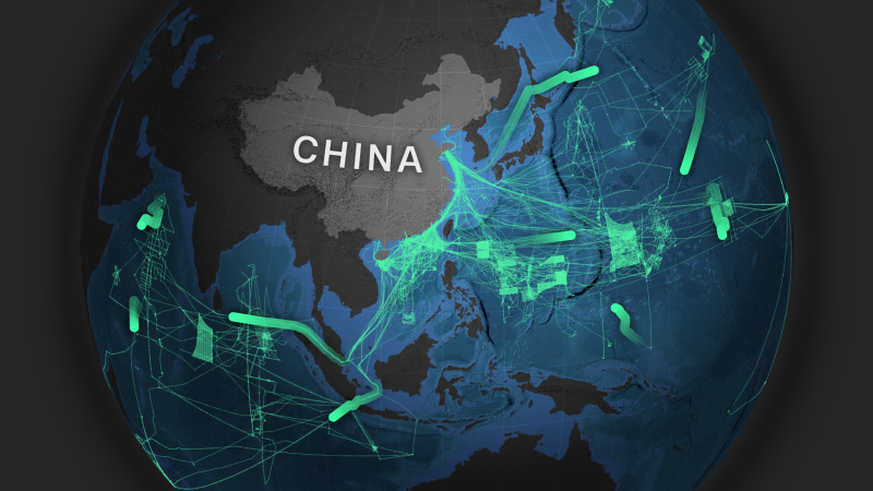
CNN and environmental news outlet Mongabay tracked eight Chinese research vessels that have undertaken deep-sea mining exploratory missions over the past five years. During that period, the ships spent only around 6% of their total open water time in areas reserved for exploration by Chinese companies, according to an analysis of data from MarineTraffic, a ship tracking and maritime intelligence provider, and the platform Deep Sea Mining Watch.
These particular vessels, along with at least five other deep-sea vessels that have previously carried out work in deep-sea mining exploration areas, display a consistent pattern of activity that points beyond purely civilian use.
Some have also shown behaviors suggesting attempts to avoid detection, including hundreds of instances of “going dark” by disabling the mandatory Automatic Identification System (AIS), a vessel’s self-reporting system that broadcasts its identity and position.
The majority are tied to state-affiliated entities with links to the Chinese navy and regularly call at its military-connected ports.
The Chinese research vessels CNN and Mongabay tracked
They are among more than 40 vessels that make up China’s blue-water marine scientific research fleet, the world’s largest, according to the China Maritime Studies Institute.
While none of this activity proves a military role on its own, taken together it strongly suggests the vessels may serve strategic, dual-use purposes as well as scientific ones, according to more than a dozen naval, civil and academic experts that CNN and Mongabay spoke with for this story.
It’s a strategy that underlines China’s military-civilian fusion policy, which blurs the line between civilian and military development to advance Chinese leader Xi Jinping’s goal to make China a “maritime power.”
Deep-sea mining exploration areas are managed by the International Seabed Authority (ISA), a UN-backed regulatory body responsible for setting the rules for this nascent mineral source-related industry.
Although these rules are not yet finalized and commercial extraction has yet to begin, China has positioned itself as a global leader, holding five of the 31 exploration contracts issued by the ISA and serving as its largest financial donor.
The ISA operates under the United Nations Convention on the Law of the Sea (UNCLOS), which the United States has not ratified – meaning its deep-sea mining ambitions are being pursued outside of this international framework. The Trump administration is now unilaterally accelerating its push to secure critical mineral supply chains as part of its broader maritime strategy, a move which could augur future frictions.
Experts warn that any deep-sea mining is expected to have significant environmental costs.
The deep ocean, often referred to as the “final frontier,” is one of the planet’s largest habitats — and least known environments. Forty countries, as well as hundreds of scientists and environmentalists, have called for a moratorium on the emergent industry, warning that mining could cause irreparable damage to species and ecosystems that have evolved over millions of years and host an extraordinary kaleidoscope of life forms, including hundreds of new species identified in 2025 alone. A study published in December in the journal Nature Ecology and Evolution found that industrial-scale deep-sea mining tests caused a 37% reduction in animal abundance within the directly mined areas of the Clarion-Clipperton Zone (CCZ), a vast expanse — approximately half the size of the United States — located between Hawaii and Mexico in the central Pacific Ocean.
Where are the exploration areas?
The ISA manages these areas, which are beyond national jurisdictions, and signs contracts with countries or entities, giving them authorization to explore.
ISA exploration area licensed to:
Chinese company or entity
South-Atlantic
Ocean Region*
ISA exploration area licensed to:
Chinese company or entity
South-Atlantic
Ocean Region*
*No areas licensed to Chinese entities
Source: International Seabed Authority
Experts say Chinese research vessels may very well be prospecting for minerals beyond their assigned exploration zones: In December 2025 and January 2026, the Shi Yan 6, or “Experiment 6,” appeared to operate within India and Germany’s exploration area in the Indian Ocean; in November, the Chinese vessel Shen Hai Yi Hao, or “Deep Sea No. 1,” appeared to operate within South Korea’s exploration area, also in the Indian Ocean. Throughout 2024, it repeatedly seemed to be operating in other nations’ contracted areas too, including those of Poland, France and Russia.
The South Korean, Polish and French licensees told CNN and Mongabay that China had alerted them in advance to the visits and that research in such areas is permissible under UNCLOS. Germany said it was unaware of the Shi Yan 6’s visit and India and Russia declined to comment.
Experts say the pattern of Chinese activity could reflect a broader strategy to lead in deep-sea mining once commercial extraction begins.
“China is playing, as it does in many cases, with international law,” said Isaac Kardon, a senior fellow for China studies at the Carnegie Endowment for International Peace.
“China is the primary actor in and around new forms of high seas navigation concerning undersea resources… They’ll be the first mover, if they can,” he added.
Against this backdrop, civilian research and economic development increasingly appear to intersect with Beijing’s broader strategic ambitions, including driving China’s maritime reach.
“They want to know what’s going on at the bottom of the sea, where US submarines might go, where their submarines might go, where other submarines might go.”
“Mapping the seafloor in those places is going to be of intense interest to them,” said Raymond Powell, a retired US Air Force colonel and the director of SeaLight, a non-profit initiative that highlights China’s “grey zone” maritime activities in the Indo-Pacific.
The Chinese Ministry of Foreign Affairs did not address any of the specific allegations in this piece, or any of CNN and Mongabay’s specific questions. However, in a statement, it said: “Within the framework of the International Seabed Authority (ISA), China conducts activities in deep-sea exploration, scientific research, and environmental protection, assisting a host of developing countries in effectively strengthening their deep-sea capacity building. This is in accordance with the provisions of the United Nations Convention on the Law of the Sea.” It added that China “highly values deep-sea environmental protection.”
Multiple Chinese research vessels assigned to deep-sea mining operations have mapped areas around Guam and the Mariana Islands in the past year, before moving across the South China Sea — a strategic, resource-rich waterway through which more than 60% of China’s maritime trade transits.
Some of the vessels routinely travel through the South China Sea with their AIS off, according to data analyzed by the monitoring organization Starboard Maritime Intelligence.
And in July, the research vessel Jia Geng came within 20 nautical miles of Taiwan’s coast, which is in its contiguous zone — the buffer surrounding its territorial waters — prompting a response from the Taiwanese coast guard.
“You just suspect that they’ve got some extra ears listening in for certain things that they’d like to know about,” said Powell of Sealight.
Chinese vessels have also conducted surveys or operated near critical undersea communication cables, Starboard Maritime Intelligence said, raising concerns about potential surveillance and sabotage.
For example, in November 2023, the Xiang Yang Hong 03 (Facing the Red Sun 03) spent 48 hours doing survey work over a known trans-Pacific cable, covering around 400 square nautical miles — an area smaller than other surveys the vessel conducted, possibly indicating a more targeted investigation to pinpoint objects of interest.
The vessel “made a fairly direct line straight to one particular part of the ocean,” where undersea cables had been laid three years prior, said Mark Douglas, a Starboard analyst. It then continued to do what appeared to be “a very focused little bit of survey work over the course of a couple of days over (the) top of the cable,” before it left the area. Douglas called the vessel’s movements “a smoking gun,” that points to likely dual-use operations.
It comes as suspected sabotage of undersea cables continues to rise, with at least eight incidents reported in both the Baltic Sea and five around Taiwan in 2024 and 2025, according to a report from the US cyber security company Recorded Future. At least five out of the nine recent incidents involved vessels dragging their anchors, with four of those ships linked to Russia or China, it said. Russia has denied allegations of any involvement. A spokesperson for China’s Taiwan Affairs Office said earlier this year that damage to undersea cables is not unusual, describing such incidents as “common maritime accidents.”
China’s intensified undersea focus comes as Beijing begins construction on a permanent deep-sea hub roughly 2,000 meters (6,500 feet) beneath the South China Sea. The manned research station, due for completion in 2030, will focus on cold-seep ecosystems — critical for understanding energy resources including hydrocarbon and gas hydrate reservoirs — while also reinforcing Chinese reach in one of the world’s most contested maritime regions.
Its oceanographic vessels, meanwhile, are equipped with cutting-edge scientific instruments for collecting marine, atmospheric and seabed data.
What research methods do they use?
Seabed mapping
Knowing the shape and makeup of the ocean floor helps experts understand how sound moves underwater. This makes it easier for naval officers to spot enemy submarines, or for vessels to choose safe depths or find places to hide. Good seabed maps also let submarines know exactly where they are without GPS. These bathymetric surveys can aid conservation efforts by identifying and mapping vulnerable areas such as seamounts and deep-sea reefs that could be in need of protection.
Seismic surveillance
Very loud sound waves, generated by some kind of transducer, or in some cases, explosive charges, can also be used to generate feedback on what the seabed might look like. This type of mapping is often used in oil and gas exploration, and can have substantial environmental impacts on a range of marine life from whales to zooplankton, experts say.
Autonomous underwater vehicles
Underwater drones quietly collect data on ocean currents, temperature and salinity. These factors directly affect how sound travels underwater, which in turn determines how effectively sonar can detect objects. Mapping this information helps to identify sonar blind spots and improve the tracking of submarines. China has heavily invested in developing autonomous vehicles for years.
China is not alone in the race to the bottom of the ocean.
In April 2025, US President Donald Trump signed an executive order bypassing international regulations to turbocharge deep-sea mining in national and international waters, framing access to the minerals as a matter of urgent national security, necessary to counter China’s supply chain dominance. Since then, it has sought to further link deep-ocean resources to this narrative, taking a series of steps to consolidate oversight of the deep-sea mining permitting process and investing billions of dollars in a project to strengthen US critical minerals supply chains, in a move that experts say could unilaterally jumpstart the commercial industry. Critics, meanwhile, warn that the marine environment could be the loser in this multinational race.
In its statement to CNN and Mongabay, the Chinese foreign ministry said Trump’s executive order placed “domestic law above international law, thereby undermining the common heritage of mankind and jeopardizing the international maritime order” and urged the US to “pull back” and “respect the international seabed system.”
The US State Department said it is “committed to the responsible development of seabed mineral resources” and that the UNCLOS “framework for deep seabed mining does not apply to non-parties like the United States, carries no weight under customary international law” and, it claimed, “has become a tool of malicious actors.”
The US Bureau of Ocean Energy Management (BOEM) has advanced efforts to assess and potentially lease areas for deep-sea mining in the Pacific (off American Samoa and the Mariana Islands) and in recent months, off the coasts of Virginia and Alaska, prompting some local and environmental opposition.
There is little evidence yet of significant friction between the US and China over deep-sea mining sites. But the two are increasingly engaged in competition in the Cook Islands, a strategically located Pacific nation with vast, cobalt-rich seabed resources — perhaps signalling how the industry could stoke future tensions.
The Cook Islands, which first considered deep-sea mining more than a decade ago, issued exploration licenses to multiple companies with US links seeking to court the Pacific nation in 2022 — although the Biden administration provided little direct backing at the time.
China’s entry in early 2025 — through agreements on deep-sea mining research — marked a turning point. In October, the US appeared to be further asserting its presence in the Cook Islands, with the US-funded E/V Nautilus expedition mapping the seafloor.
While some US National Oceanic and Atmospheric Administration (NOAA) ships have supported the US Navy and broader national security interests through data sharing, and collaborative research, it is unclear whether vessels involved in deep-sea mining track Chinese submarines or perform similar military work. Experts interviewed for this story found no evidence that US deep-sea mining ships conduct surveillance missions, and neither NOAA nor the Navy commented on the matter.
Still, for many Cook Islands residents, the moves have raised alarm about the country’s growing entanglement in a rivalry between the two superpowers.
“We are concerned that the Cook Islands is becoming a melting pot between two major states facing off against each other by equipping themselves with deep-ocean minerals that could be used to support their military defense,” said Alanna Matamaru Smith, director of Te Ipukarea Society, a local environmental organization.
“These states don’t care about us or the long-term environmental impacts they may leave behind. They only care about protecting themselves”
First Appeared on
Source link

