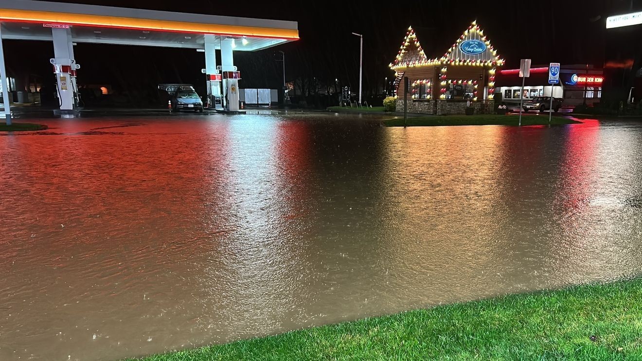
Major highways closed, evacuations, flash flood watch underway amid flood emergency
WESTERN WASHINGTON — A flood emergency is underway in western Washington as a second surge of heavy rain is causing rivers across the region to rise.
Many are expected to crest on Thursday, and in some cases, especially along the Skagit River, the flooding will prove to be historic.
PHOTOS: Flooding across western Washington
Gov. Bob Ferguson declared a state of emergency and activated the National Guard to assist with flooding. About 300 service members will be staged and ready to respond.
As many as 100,000 residents could be forced to evacuate when rivers reach historic levels.
Residents are urged to sign up for emergency alerts.
Level 3, “GO NOW” evacuations have occurred in Skagit County for residents living within the 100-year floodplain, in Concrete due to historic flooding on the Skagit and Sauk rivers, Sumas in Whatcom County, Mount Vernon, and others.
Dozens of area roads are closed along with major highways.
- Eastbound Interstate 90 is closed between Snoqualmie and North Bend
- Both directions of US 2 are closed from Index over Stevens Pass to Coles Corner due to slides and flooding.
- Both directions of SR 20 closed in Marblemount due to water on the road between Conrad Road and Cascade River Road.
WEATHER | Interactive Radar
RESOURCES | Flood stages for area rivers
ROAD CLOSURES | Snohomish County | Unincorporated King County | Lewis County | Pierce County | Skagit County | State highways
A second surge of atmospheric-river driven precipitation continues, and 18 rivers in the region are set to experience what is classified as major flooding.
The Skagit is projected to crest in Concrete Thursday morning at 48 feet and in Mount Vernon Friday morning at over 42 feet. In both cases, this will be about 4 to 6 feet higher than the previous record high water marks. There is also worry that the extreme water pressure might force a levee or dike breach along the Skagit River Valley.
As such, a rare flash flood watch is in effect for much of Skagit and parts of northern Snohomish counties. If you live near the river, prepare to evacuate to higher ground and heed all evacuation orders.
Several other rivers will be near record levels, including the Snoqualmie, Skykomish, Stillaguamish, and Snohomish. All area waterways will crest from Thursday into Friday as the swell of high water works its way from the hills on down to sea level.
Nearly a foot of rain has fallen in parts of the Olympics and Cascades in the first 10 days of December. Olympia has tallied up over 6 inches of rain; more than 10% of the average annual rainfall in just a week and a half.
Cooler air fills in on Thursday, dropping readings back into the more typical upper 40s to near 50 degrees from Mukilteo to Eatonville. The snow level will lower to about 4,000 to 5,000 feet — low enough to release some of the pressure on the rivers. The rain will turn to more widely scattered showers.
Friday and Saturday will be mainly dry, highs will hover in the low 50s, with rain falling mainly north of the Peace Arch. All of our raging rivers will crest and head back down by the end of the week.
That changes late Saturday night into Sunday as the precipitation starts to sag south of the border again. The rain picks up the pace as highs once again warm into the mid to upper 50s on Monday, putting renewed pressure on our waterways. It will also be gusty, with southerly winds blowing to 30 mph or more through western Washington.
Then a dramatically cooler change takes shape Tuesday into Wednesday as cooler air spills into the region. The snow level will come down to 2,000 feet or so by the middle of the week –finally bringing snow to the ski resorts, but also bringing sleet to the foothills.
First Appeared on
Source link

