N.J. weather: Strong storm system to bring heavy rain, damaging winds to region
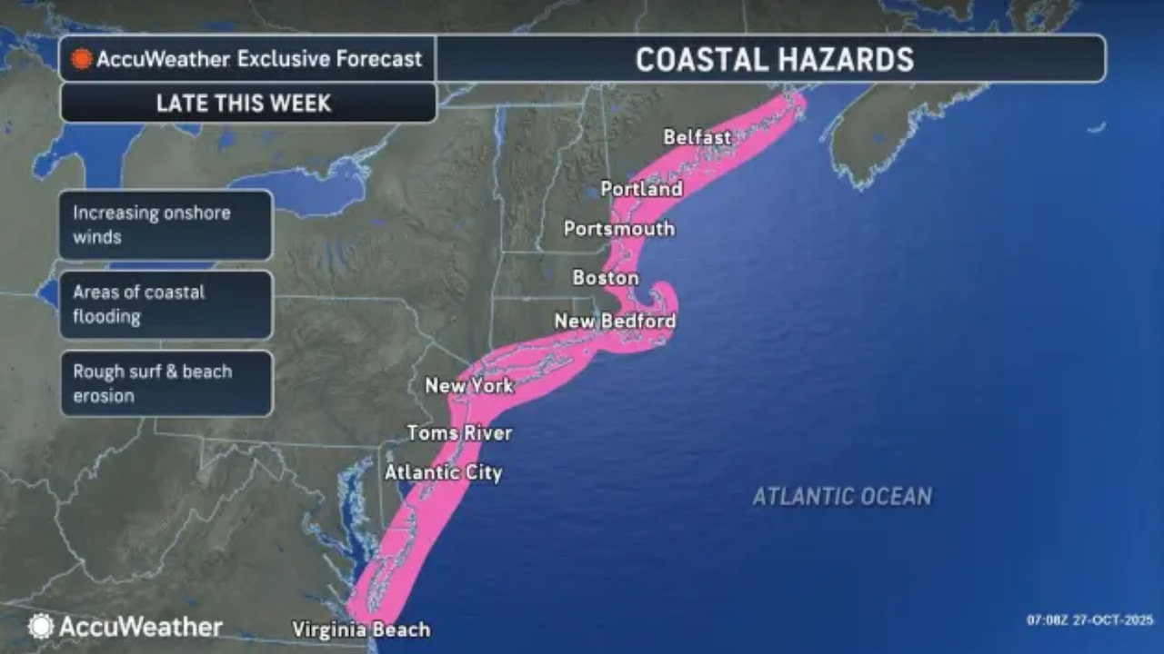
A strong storm system could bring 1 to 3 inches of rain and wind gusts as high as 40 to 50 mph to New Jersey on Wednesday and Thursday, and gusty winds could linger through Halloween.
That’s the latest forecast from the National Weather Service, which says the storm system could include some isolated thunderstorms, minor tidal flooding and spotty damage to trees and power lines.
Tuesday will start with clear skies before clouds gradually increase throughout the day. Northeast winds will strengthen, with gusts reaching 15 to 20 mph inland and 20 to 30 mph along the coast.
High temperatures will warm into the mid- to upper 50s, with a few light showers possible along the immediate coast in the afternoon.
Wednesday will bring more unsettled conditions as a developing storm system approaches our region.
Forecasters from the weather service say it’s a complicated setup, with “a broad area of low pressure extending from the Tennessee Valley to the Carolina coast Wednesday night consolidating into one low pressure system Thursday.”
Showers are likely along the immediate coast overnight Tuesday into Wednesday, with a 25% to 40% chance of showers further inland.
Onshore flow will strengthen with northeast winds of 25-35 mph along the coast and 20 to 30 mph gusts inland. Temperatures will reach the mid- to upper 50s and low 60s.
The most significant weather impacts will occur Thursday through Thursday night as the complex storm system moves through the region.
A period of moderate to heavy rain is expected, with widespread rainfall amounts of 1 to 3 inches possible. The heaviest rain will likely fall over a 6- to 12-hour period, raising concerns for flooding in urban areas and on streets with bad drainage.
The National Weather Service says there’s a marginal, or low, risk for excessive rainfall for nearly the entire state.
In addition to heavy rain, strong winds will develop with gusts of 30 to 40 mph expected Thursday, potentially reaching 50 mph by Friday, Halloween. The combination of rain and wind could lead to minor to moderate coastal flooding during high tide cycles, particularly Thursday night, the weather service said.
The storm system will begin to pull away Friday, though gusty winds will continue with westerly gusts of 40 mph possible as temperatures remain in the mid- to upper 50s.
Forecasters note there remains some uncertainty about the exact track of the storm, which could impact rainfall totals and the potential for severe weather.
Current weather radar
If you purchase a product or register for an account through a link on our site, we may receive compensation. By using this site, you consent to our User Agreement and agree that your clicks, interactions, and personal information may be collected, recorded, and/or stored by us and social media and other third-party partners in accordance with our Privacy Policy.
First Appeared on
Source link

