N.J. weather: Weekend snow threat hinges on coastal storm track. Latest forecast updates.
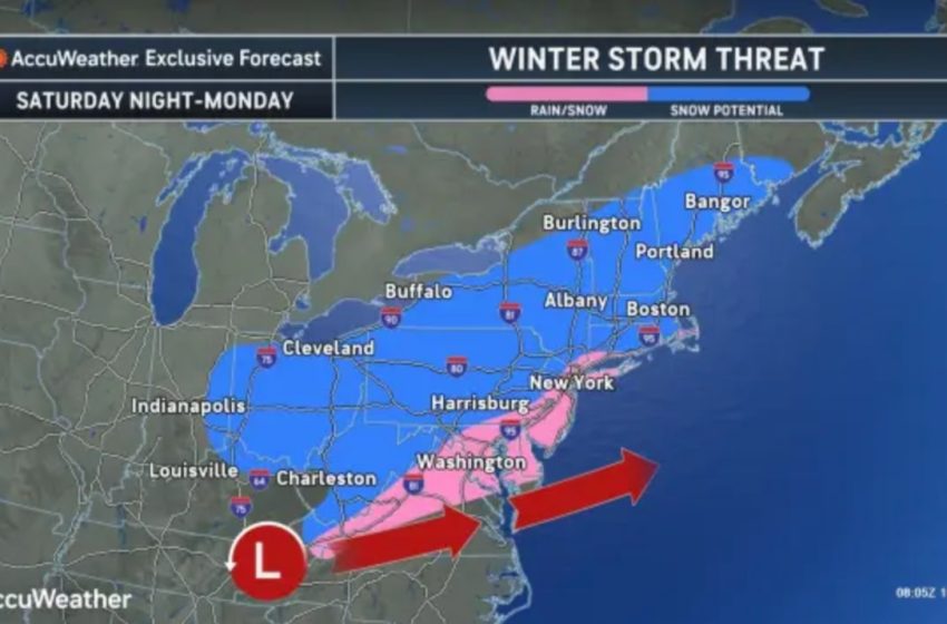
The threat of a coastal storm that could bring snow to New Jersey late this weekend remains murky as of Thursday morning, with conflicting predictions, forecasters say.
“Sunday’s storm potential is still highly uncertain,” the National Weather Service said early Thursday. “The region will be on the northwestern edge of a potential coastal storm forecast to be just offshore on Sunday and Monday.”
The weather service said some forecast models predict light to moderate snow, particularly for southern New Jersey, while others suggest rain or even no precipitation at all.
The storm’s track, timing and availability of cold enough air for snow are all factors that could sway the outcome.
Snowfall forecast predictions have not yet been issued for the possible Sunday night storm.
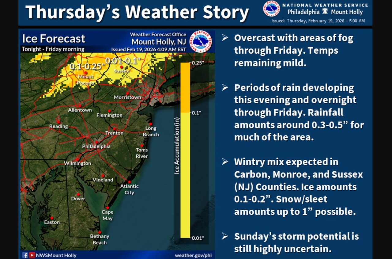
The forecast for Thursday calls for cloudy conditions with occasional light rain, drizzle, mist and fog.
“Mild and cloudy today, with highs in the upper 30s to mid 40s,” the weather service said. “Periods of rain will develop tonight through Friday, with about 0.3-0.5 inches of rain forecast.”
Light snow and freezing rain are possible across the higher elevations of northwestern New Jersey starting after 7 p.m. tonight through noon Friday.
A winter weather advisory has been issued for Sussex County with slick roads possible, the weather service said.
Temperatures will gradually warm Friday as milder air moves into the region, with areas near the Jersey Shore reaching the upper 40s to low 50s by Saturday as cloud cover breaks up.
Following the possible coastal storm Sunday into Monday, expect colder temperatures for New Jersey early next week.
Highs in the mid 30s to near 40 degrees are forecast both Monday and Tuesday, and lows in the mid teens and 20s.
Current weather radar
First Appeared on
Source link

