Red alert as Storm Kristin brings 200km/h hurricane force winds
SPAIN is bracing for a weather ‘beast’ today as Storm Kristin makes landfall with potentially destructive winds.
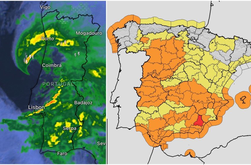
State weather agency Aemet has issued maximum ‘red level’ alerts for parts of the country for today, Wednesday, and tomorrow.
Meteorologists are warning of a rare and violent phenomenon known as a ‘sting jet’, or chorro de aguijon in Spanish.
This weather event involves a core of extremely high-speed winds descending from the cloud head of the storm.
Experts warn that this ‘sting’ could bring gusts approaching 200km/h, capable of causing widespread destruction.
The storm is currently undergoing ‘explosive cyclogenesis’—often called a weather bomb—as it slams into the Iberian Peninsula.
While the eye is making landfall between Lisbon and Porto in Portugal, the effects are being felt violently across Spain.
Gusts of 177km/h have already been recorded in Monte Real near the Portuguese border.
The wind is so intense that radar systems in northern Portugal have reportedly been knocked offline.
In Andalucia, authorities are taking no chances.
The Junta has issued a warning to all schools to exercise ‘extreme caution’ in outdoor areas throughout the school day which, controversially, have not been closed.
The warning follows guidance from the 112 emergency service as the region prepares for heavy rain and gale-force winds.
The storm comes just days after Storm Joseph battered the coast, leaving ground saturated and increasing the risk of falling trees and landslides.
Aemet has warned the public to exercise maximum caution, describing the day as ‘dangerous’.
Snow is also expected in mountain areas of the south and center of the peninsula.
The wet and windy weather is forecast to continue until at least Friday, with early models suggesting February could see rainfall well above average.
Click here to read more Weather News from The Olive Press.
First Appeared on
Source link

