Submarine Disappears Beneath Antarctic Ice After Spotting Bizarre Structures No Scientist Has Seen Before
A robotic submersible operating beneath one of Antarctica’s most closely monitored ice shelves vanished in January 2024 during a scheduled mission. The vehicle, part of a long-running international effort to understand ice shelf dynamics and their link to rising sea levels, had previously delivered the most detailed subglacial maps ever recorded in the region.
The disappearance occurred beneath the Dotson Ice Shelf, a floating ice platform in West Antarctica. Before losing contact, the submersible completed an extensive survey beneath the ice, revealing previously undocumented features on the glacier’s underside. These included patterned formations that do not appear in existing ice melt models.
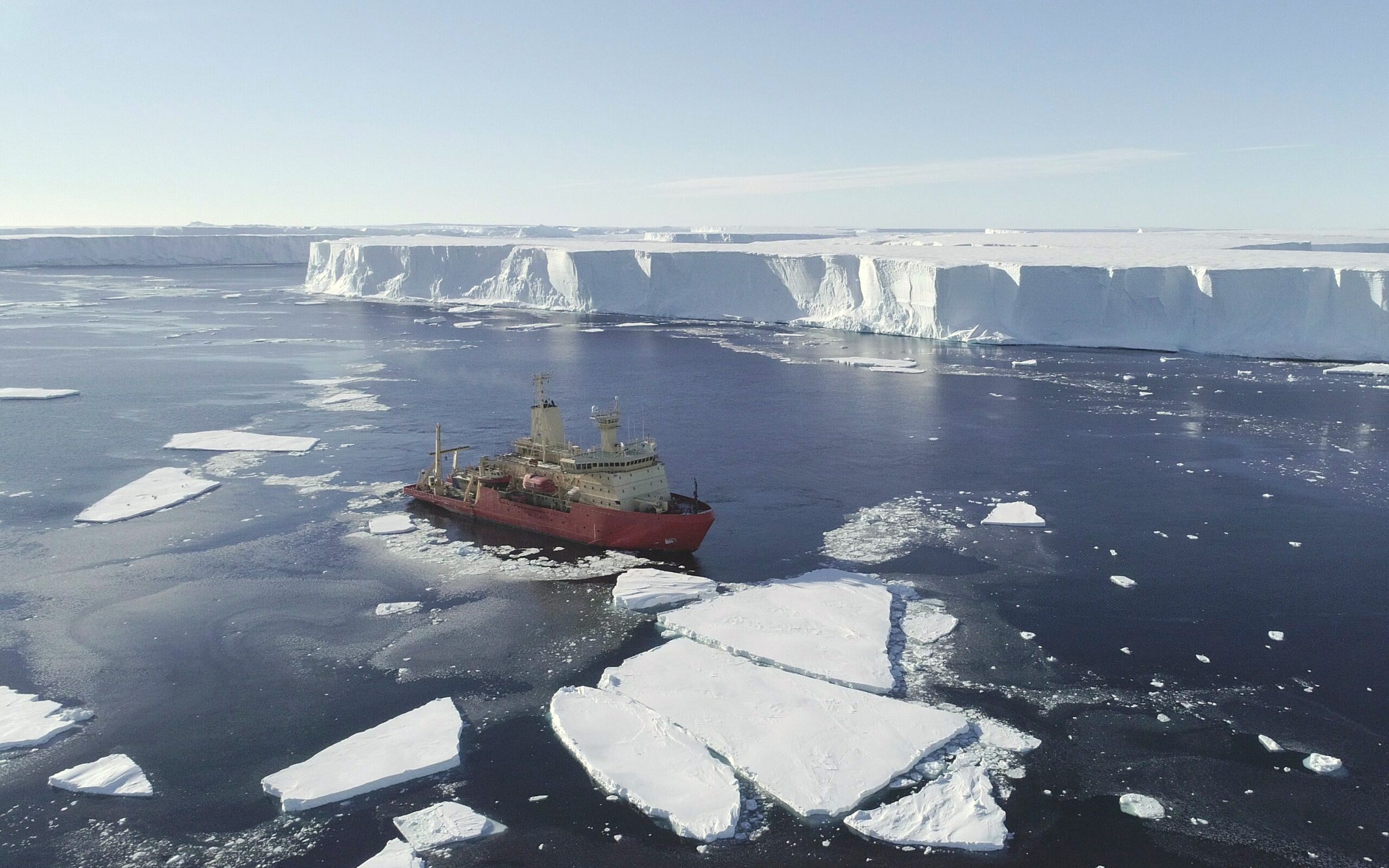
Although the mission was unmanned, the incident resulted in the loss of a highly specialized vehicle and has paused a broader data collection effort across the Amundsen Sea, a critical zone in the study of West Antarctic glacial stability. No signal was received after the vehicle’s expected resurfacing window, and acoustic searches yielded no results. The vehicle’s final location remains unknown.
Sub-Ice Mapping Reveals Melt Structures Shaped by Ocean Flow
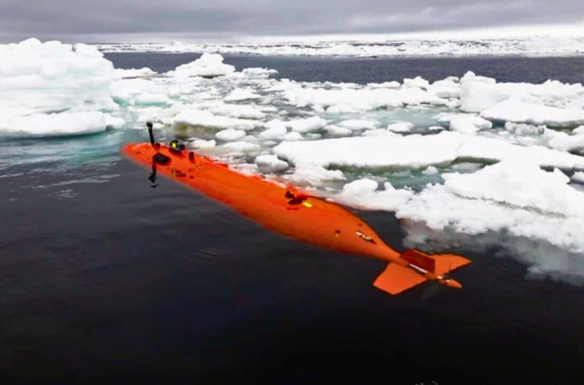
The submersible, named Ran, was developed in Sweden and deployed as part of the International Thwaites Glacier Collaboration, a joint US-UK research program studying the West Antarctic Ice Sheet. It completed a 27-day mission beneath Dotson in early 2022, returning with data that significantly expanded understanding of basal melt processes.
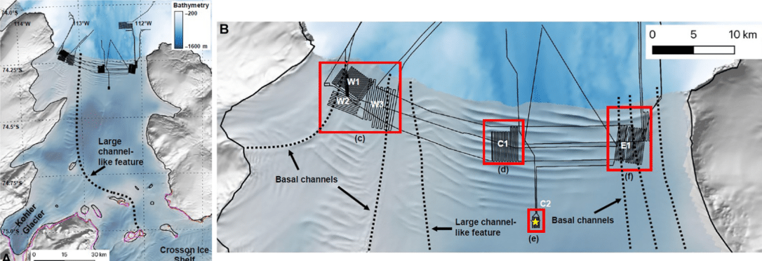
The survey covered approximately 140 square kilometers beneath the ice shelf. Using multibeam sonar operating at a 50-meter distance from the ice base, Ran mapped features including flat terraces, deep melt channels, and smooth erosion zones. The formations varied in structure depending on their position beneath the shelf and the characteristics of the surrounding water flow.
In the central and eastern sections, researchers identified stair-like terraces and plateaus with sharp vertical faces. These are consistent with low-turbulence melting driven by slower-moving currents. The western regions, by contrast, showed smoother surfaces and signs of erosion attributed to faster, shear-driven flow.
The findings were published in a peer-reviewed study in Science Advances. Oceanographic data collected from ship-based sensors and a borehole confirmed that modified Circumpolar Deep Water, a relatively warm current, enters the cavity beneath Dotson and contributes directly to melt rates in the most affected zones.
Fractures and Teardrop-Shaped Formations Mark Structural Weaknesses
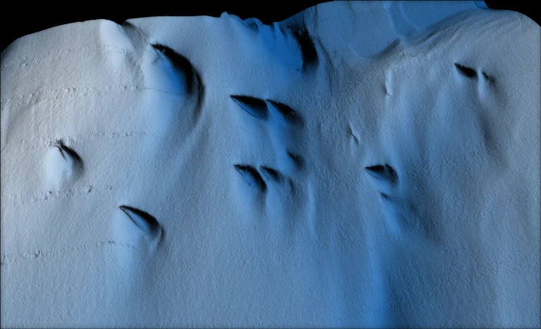
In addition to mapping melt zones, Ran’s sonar revealed full-thickness ice fractures extending through the base of the shelf. Some of these fractures have been visible in satellite imagery since the 1990s. At depth, they appear to widen and are often bordered by small-scale terraces and erosion features, indicating persistent melt along their walls.
The survey also documented a class of features not previously observed beneath Antarctic shelves. In high-velocity outflow zones, particularly in the west, the sonar detected elongated, teardrop-shaped indentations in the ice base. These features ranged from 20 to 300 meters in length and up to 50 meters in depth.
Their orientation and shape suggest formation through boundary-layer flow rotation. Researchers proposed a link to Ekman dynamics, where rotating ocean currents within a thin layer beneath the ice generate asymmetric melt patterns. This hypothesis was developed based on velocity and salinity measurements detailed in the Science Advances study, which linked flow behavior to observed erosion features beneath the shelf.
The teardrop features were not visible on the surface, which is consistent with bridging stresses preventing surface deformation that mirrors basal changes.
Submersible Loss Halts Key Follow-up Research
Ran re-entered the Dotson sub-ice cavity in January 2024 for a follow-up survey intended to assess changes since the initial mission. The vehicle was scheduled for a 24-hour dive. No live tracking was available during the operation due to the thickness of the ice, and no signal was received after the scheduled return time.
The loss was confirmed by the British Antarctic Survey, which participated in the mission. No acoustic beacon or debris field has been detected since the disappearance. Potential causes under review include equipment failure or collision with uncharted basal formations.
Despite the operational setback, the original 2022 dataset remains intact. The multibeam imagery continues to inform revised estimates of basal melt and ice shelf retreat in the Amundsen Sea sector.
Revised Models Needed to Reflect Focused Melt Patterns
Measurements from Ran showed that melt beneath the Dotson Ice Shelf is not uniform. Terraces, channels, and erosion zones coincide with directional ocean flow patterns and with long-standing ice fractures. High melt rates, reaching up to 15 meters per year in some areas, were linked to warm water intrusion along deep sub-ice troughs and narrow channels.
The sonar maps confirmed that Dotson’s thinning is concentrated along its western flank. This supports earlier findings from satellite altimetry and ocean model simulations, which suggested asymmetric basal melting driven by ocean current pathways. Between 1979 and 2017, the Dotson Ice Shelf contributed approximately 0.02 inches to global sea level rise, based on estimates published in Science Advances.
Since the early 2000s, Dotson has lost nearly 390 gigatonnes of ice. This figure is supported by data from oceanographic sensors, satellite-derived surface altimetry, and modeled ice flux estimates from the Thwaites Glacier research network.
Multibeam sonar imaging was completed in six survey zones, covering the western, central, and eastern parts of the shelf. Ocean currents were recorded at depths of 20 to 80 meters below the ice. Inflow of warm, salty water from the eastern flank and outflow of fresher meltwater to the west were recorded during the survey using onboard conductivity-temperature-depth sensors.
First Appeared on
Source link

