‘Potent’ storm hits SoCal as Palisades, Eaton and other recent fire zones are under evacuation warnings
Evacuation warnings have been issued for recently burned areas in the foothills of the Santa Monica and San Gabriel mountains as an early-season storm bringing heavy rain enters the region Monday night.
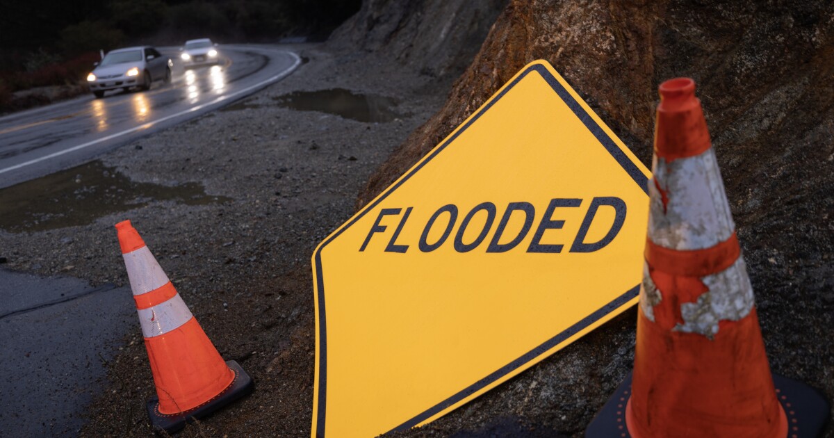
Rainfall rates could reach 1 inch per hour, exceeding the threshold required to trigger debris flows in some recently burned spots.
Forecasters described the turn in the weather, which is also bringing in a cold front, as “a rare and very potent storm system.”
As of late Monday, National Weather Service said the forecast continued to be for “widespread rain tonight through Tuesday, with a threat of pockets of heavy rain and thunderstorms.”
And they warned of “significant risk of debris flows, road flooding, and isolated wind damage.”
Radar Update: Rain from the low to the north is starting to move into San Luis Obispo Co. This is the very beginning, so expecting quite a bit more rain as we move into tonight and Tues AM. So far things look tame, but activity looks more intense to the north. #CArain #sloRAIN pic.twitter.com/lkGqD4NnvE
— NWS Los Angeles (@NWSLosAngeles) October 14, 2025
Warnings in place
Warnings have been issued for the following L.A. County areas (up-to-date map here):
- Eaton Fire burn scar (Altadena, Pasadena)
- Palisades Fire burn scar (Pacific Palisades)
- Sunset Fire burn scar (Hollywood Hills)
- Canyon Fire burn scar (Hasley Canyon and Val Verde communities)
- Hawk Fire burn scar (Acton)
- Bridge Fire burn scar (mountains north of La Verne)
In Santa Barbara, residents in and around burn cars for the Gifford Fire the Lake Fire are also now under evacuation warnings.
Santa Barbara officials advised Monday night: “If you feel threatened, leave before the rain begins.”
Earlier officials cautioned flash flooding was possible — around the Lake, Madre and Gifford fire burn scars.
The storm is expected to hit Monday night and last into early Tuesday, dropping as much as 4 inches of rain on south-facing slopes.
Forecasters say the coasts and valleys could see up to an 1.5 inches of rain, while mountains and foothills could see more than 3 inches of rain. Isolated pockets of intense rainfall are likely.
Widespread flood watches (meaning be alert to conditions and prepared to move if necessary) have been issued by the National Weather Service from San Luis Obispo to San Clemente from Monday night through Tuesday afternoon.
Several inches of snow could fall above 7,000 feet.
In addition to significant rain, be prepared for potentially damaging winds, hail and even short-lived tornadoes.
Avoid traveling and outdoor activities for the duration of the storm.
In addition:
- Avoid parking near tall trees.
- Be ready for sudden power outages.
- Avoid the roads as much as possible.
- If you have to drive, allow extra time.
Gov. Gavin Newsom said the state has resources ready to go to respond to mudslides.
Later this week we should see a return to warmer, drier weather.
Storm information by county
For the most up-to-date information on the storm from your local authorities, you can check:
Prepare for mudslides
The L.A. County Department of Public Works is forecasting that isolated debris and mudflows are possible that could affect streets and structures near the following 11 burn areas:
- Eaton Fire (Altadena, Pasadena)
- Palisades Fire (Pacific Palisades)
- Hawk Fire (Acton)
- Canyon Fire (Hasley Canyon and Val Verde communities)
- Franklin Fire (Malibu)
- Hughes Fire (Castaic Lake)
- Kenneth Fire (West Hills)
- Sunset Fire (Hollywood Hills)
- Lidia Fire (Acton)
- Hurst Fire (Sylmar)
- Bridge Fire (San Gabriel River at East Fork area in L.A. County, communities of Wrightwood, Big Pines, and Mt. Baldy Village)
Sign up for emergency alerts
Understanding National Weather Service warnings
Here’s an excerpt from our guide to understanding flood warnings, if any are issued:
- Flood advisories are how the NWS begins to raise the alarm. The goal is to give people enough time to take action.
- Flood watches are your indicators to get prepared to move.
- A flood warning is issued when a hazardous weather event is imminent or already happening. When one is issued for your area, you need to get to higher ground immediately.
- A flash flood warning is issued when a flash flood is coming or in progress. Flash floods are sudden and violent floods that can start within minutes.
Read more: Flash flood warnings? Watches? Here’s what you need to know
Tips for driving in the rain
- Check weather and road conditions along your planned route.
- Slow down.
- Keep a wider-than-usual distance between your vehicle and the one in front.
- Don’t drive through standing water — as little as 12 inches of rushing water can carry away most cars, and 2 feet can carry away SUVs and trucks.
- Make sure tires are fully inflated.
- Check windshield wiper blades and replace if necessary.
Read more: What you should do if you end up driving in a flooded area
Downed tree, power line or flooded road?
Dial 911 if it’s an emergency.
However, if you need to report a flooded road or a downed tree, you can call the following non-emergency numbers:
- L.A. city: Dial 311 for a flooded road or downed tree. Call (800) DIAL-DWP if you see a downed power line.
- L.A. County: (800) 675-HELP
- Ventura County: (805) 384-1500
- Orange County: (714) 955-0200 or visit here.
If you’re in L.A. County and need sand bags, you can find some at local fire houses.
How we’re reporting on this
LAist reporters will provide updates on the storm as it moves through. If things get hairy, we’ll send reporters into the field to give you real-time updates about conditions on the ground.
This is a developing story. We fact check everything and rely only on information from credible sources (think fire, police, government officials and reporters on the ground). Sometimes, however, we make mistakes or initial reports turn out to be wrong. In all cases, we strive to bring you the most accurate information in real time and will update this story as new information becomes available.
First Appeared on
Source link

